IMRAY CHART M17 TUSCAN ISLANDS TO ROME

REF: 31452

On this the latest known depths have been applied. Harbour developments at Civitavecchia and Fiumicino are included as is the restricted area on the approach to Anzio. The Corsican Channel TSS is shown, as are the extents of Marine Protected Areas on this chart. The chart specification has been improved to show coloured light flashes. There has been general updating throughout.

3 in stock

37.50

SKU: IM3029X00172 Category: Brand:

Description

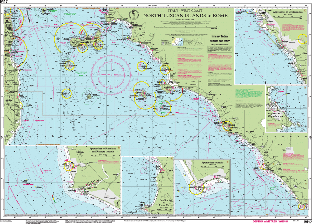
M17 North Tuscan Islands to Rome

Scale: 1:325,000 WGS 84

Chart scale 1:325 000

Plans included:
Scarlino to Punta Ala (1:85 000)
Approaches to Giglio Marina (1:10 000)
Approaches to Civitavecchia (1:40 000)
Approaches to Fiumicino and Fiuma Grande (1:50 000)
Approaches to Anzio (1:50 000)